Geolocate

Tappahannock topographic map

Click on the map to display elevation.

About this map

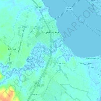
Name: Tappahannock topographic map, elevation, terrain.

Location: Tappahannock, Essex County, Virginia, United States (37.89771 -76.88185 37.93840 -76.85188)

Average elevation: 20 ft

Minimum elevation: -7 ft

Maximum elevation: 138 ft

Essex County trails, hiking, mountain biking, running and outdoor activities

Other topographic maps

Click on a map to view its topography, its elevation and its terrain.

Dunnsville

United States > Virginia > Essex County

Average elevation: 69 ft

Caret

United States > Virginia > Essex County

Average elevation: 98 ft

Gear up for your next adventure:

🪶Camping Sleeping Pad - Comfortable sleeping pad for backpacking
🎒Hydration Pack - Hands‑free water reservoir for long hikes
🎒Day Hiking Backpack - Lightweight backpack perfect for day trips and outdoor adventures
📱Heavy-Duty Phone Cases - Drop-proof and waterproof protection for outdoor navigation
🪵Folding Camp Saw - Compact saw for wood and campsite work

As an Amazon Associate, this site earns from qualifying purchases at no extra cost to you.