Geolocate

Caret topographic map

Click on the map to display elevation.

About this map

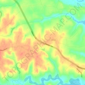
Name: Caret topographic map, elevation, terrain.

Location: Caret, Essex County, Virginia, United States (37.96264 -76.98136 38.00264 -76.94136)

Average elevation: 98 ft

Minimum elevation: 0 ft

Maximum elevation: 180 ft

Essex County trails, hiking, mountain biking, running and outdoor activities

Other topographic maps

Click on a map to view its topography, its elevation and its terrain.

Tappahannock

United States > Virginia > Essex County

Average elevation: 20 ft

Gear up for your next adventure:

📶Vehicle Signal Boosters - Improve reception in rural areas while driving to trailheads
📖Nature Tracking Books - Learn to track wildlife and terrain
Camping Coffee Makers - Enjoy premium coffee at the summit or campsite
🛰️Handheld GPS Units - Professional satellite navigators for precise backcountry mapping
🔌Solar Panel Charger - Charge gear sustainably outdoors

As an Amazon Associate, this site earns from qualifying purchases at no extra cost to you.