
望夫镇 topographic map
Interactive map
Click on the map to display elevation.
About this map
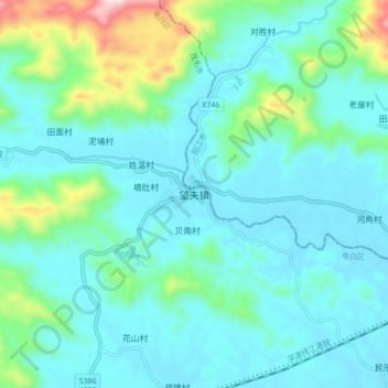
Name: 望夫镇 topographic map, elevation, terrain.
Location: 望夫镇, 茂名市, 广东省, 中国 (21.69495 111.33888 21.77495 111.41888)
Average elevation: 354 ft
Minimum elevation: 43 ft
Maximum elevation: 1,814 ft
Other topographic maps
Click on a map to view its topography, its elevation and its terrain.