Geolocate

Clowne topographic map

Click on the map to display elevation.

About this map

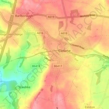
Name: Clowne topographic map, elevation, terrain.

Location: Clowne, Bolsover, Derbyshire, East Midlands, England, United Kingdom (53.25660 -1.30718 53.29268 -1.23902)

Average elevation: 420 ft

Minimum elevation: 220 ft

Maximum elevation: 538 ft

Other topographic maps

Click on a map to view its topography, its elevation and its terrain.

Pleasley Vale

United Kingdom > England > Derbyshire > Bolsover

Average elevation: 377 ft

Newton

United Kingdom > England > Derbyshire > Bolsover

Average elevation: 469 ft

Langwith

United Kingdom > England > Derbyshire > Bolsover

Average elevation: 325 ft

Hodthorpe

United Kingdom > England > Derbyshire > Bolsover

Average elevation: 256 ft

New Houghton

United Kingdom > England > Derbyshire > Bolsover

Average elevation: 489 ft

Hilcote

United Kingdom > England > Derbyshire > Bolsover

Average elevation: 463 ft

Shuttlewood

United Kingdom > England > Derbyshire > Bolsover

Average elevation: 358 ft

Upper Langwith

United Kingdom > England > Derbyshire > Bolsover

Average elevation: 367 ft

Palterton

United Kingdom > England > Derbyshire > Bolsover

Average elevation: 436 ft

Westhouses

United Kingdom > England > Derbyshire > Bolsover > Westhouses

Average elevation: 397 ft

Gear up for your next adventure:

📖Nature Tracking Books - Learn to track wildlife and terrain
🥾Men's Hiking Boots - Durable, waterproof footwear for rugged terrain and steep inclines
🌧️Backpack Rain Cover - Keep gear dry in wet weather
🩳Quick‑Dry Hiking Shorts - Comfortable and quick‑dry shorts for summer hiking
🌎3D Topographic Globes - Raised relief globes for a tactile understanding of geography

As an Amazon Associate, this site earns from qualifying purchases at no extra cost to you.