
Yopal topographic map
Interactive map
Click on the map to display elevation.
About this map
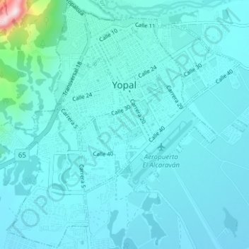
Name: Yopal topographic map, elevation, terrain.
Location: Yopal, Casanare, Colombia (5.29500 -72.42695 5.35657 -72.36476)
Average elevation: 1,102 ft
Minimum elevation: 919 ft
Maximum elevation: 3,117 ft
Other topographic maps
Click on a map to view its topography, its elevation and its terrain.
San Francisco
San Francisco, Recetor, Casanare, Colombia
Average elevation: 4,800 ft
Villanueva
Colombia > Casanare > SAN JOSE BUBUY
Villanueva, SAN JOSE BUBUY, Casanare, Colombia
Average elevation: 771 ft