Geolocate

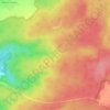
52210 topographic map

Click on the map to display elevation.

About this map

Name: 52210 topographic map, elevation, terrain.

Location: 52210, Arc-en-Barrois, Chaumont, Haute-Marne, Grand Est, France métropolitaine, France (47.81060 4.82879 48.01543 5.22717)

Average elevation: 1,194 ft

Minimum elevation: 738 ft

Maximum elevation: 1,722 ft

Other topographic maps

Click on a map to view its topography, its elevation and its terrain.
Montrot

France > Grand Est > Haute-Marne > Arc-en-Barrois

Average elevation: 1,135 ft

La Vendue

France > Grand Est > Haute-Marne > Arc-en-Barrois

Average elevation: 1,230 ft

La Petite Forêt

France > Grand Est > Haute-Marne > Arc-en-Barrois

Average elevation: 1,010 ft

Sautreuil

France > Grand Est > Haute-Marne > Arc-en-Barrois

Average elevation: 1,253 ft

Gear up for your next adventure:

🧭GPS Watch Accessories - Bands and chargers for GPS watches
🔦Powerful Headlamps - Ultra-bright hands-free lighting for night navigation
🩳Quick‑Dry Hiking Shorts - Comfortable and quick‑dry shorts for summer hiking
🎒Trail Energy Bars - High‑calorie bars for hiking energy
⛺Backpacking Tents - Weight-optimized shelters for multi-day topographic surveys

As an Amazon Associate, this site earns from qualifying purchases at no extra cost to you.