
Make a donation
Gear up for your next adventure:
As an Amazon Associate, this site earns from qualifying purchases at no extra cost to you.
Na topographic map
Click on the map to display elevation.
Make a donation
Gear up for your next adventure:
As an Amazon Associate, this site earns from qualifying purchases at no extra cost to you.
About this map
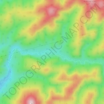
Name: Na topographic map, elevation, terrain.
Average elevation: 1,398 ft
Minimum elevation: 961 ft
Maximum elevation: 1,949 ft
Make a donation
Gear up for your next adventure:
As an Amazon Associate, this site earns from qualifying purchases at no extra cost to you.
Other topographic maps
Click on a map to view its topography, its elevation and its terrain.
Kuril Islands
The chain ranges from temperate to sub-Arctic climate types, and the vegetative cover consequently ranges from tundra in the north to dense spruce and larch forests on the larger southern islands. The highest elevations on the islands are Alaid volcano (highest point: 2,339 m or 7,674 ft) on Atlasov Island at…
Average elevation: 7 ft
Shikotan
Russia > Sakhalin Oblast > Yuzhno-Kurilsky District > Krabozavodskoye
The total land area of Shikotan is 225 square kilometers (87 sq mi). The island is hilly, averaging 300 metres in elevation. The shores of the island are very indented and covered with oceanic meadows. The highest altitude is 412 m. The island is formed by the volcanic rock and sandstone of the Upper…
Average elevation: 102 ft
Make a donation
Gear up for your next adventure:
As an Amazon Associate, this site earns from qualifying purchases at no extra cost to you.
Kuril Islands
The chain ranges from temperate to sub-Arctic climate types, and the vegetative cover consequently ranges from tundra in the north to dense spruce and larch forests on the larger southern islands. The highest elevations on the islands are Alaid volcano (highest point: 2,339 m or 7,674 ft) on Atlasov Island at…
Average elevation: 7 ft
Make a donation
Gear up for your next adventure:
As an Amazon Associate, this site earns from qualifying purchases at no extra cost to you.
Make a donation
Gear up for your next adventure:
As an Amazon Associate, this site earns from qualifying purchases at no extra cost to you.
Urup
Russia > Sakhalin Oblast > Kurilsky District
Nicolson, energetic and thorough, initiated a hydrographic survey, ordered topographic observations, and named prominent points. The central event during their stay at Urup was the annexation on 2 September 1855. Details of the proceedings, preserved in Nicolson's dispatch, highlighted the allies' declaration…
Average elevation: 177 ft
Make a donation
Gear up for your next adventure:
As an Amazon Associate, this site earns from qualifying purchases at no extra cost to you.
Славута
Russia > Sakhalin Oblast > городской округ Южно-Сахалинск > Yuzhno-Sakhalinsk
Average elevation: 341 ft
Make a donation
Gear up for your next adventure:
As an Amazon Associate, this site earns from qualifying purchases at no extra cost to you.