Geolocate

Golden Valley topographic map

Click on the map to display elevation.

About this map

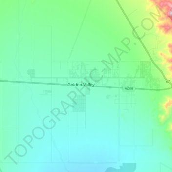
Name: Golden Valley topographic map, elevation, terrain.

Location: Golden Valley, Mohave County, Arizona, United States (35.19978 -114.30681 35.24365 -114.12662)

Average elevation: 2,930 ft

Minimum elevation: 2,503 ft

Maximum elevation: 5,167 ft

Mohave County trails, hiking, mountain biking, running and outdoor activities

Other topographic maps

Click on a map to view its topography, its elevation and its terrain.

Golden Valley

United States > Arizona > Mohave County > Golden Valley

Average elevation: 2,930 ft

Gear up for your next adventure:

🥤Water Filter Bottle - All‑in‑one filter bottle for safe hydration
🧴Hand Sanitizer - Keep hands clean while hiking
🥄Camping Utensil Set - Lightweight utensils for outdoor meals
🧢Outdoor Hiking Hat - Sun protection hat for outdoor explorers
🌡️Handheld Weather Meters - Measure wind, temp, and pressure for safe mountain travel

As an Amazon Associate, this site earns from qualifying purchases at no extra cost to you.