Geolocate

Fairfield Island topographic map

Click on the map to display elevation.

About this map

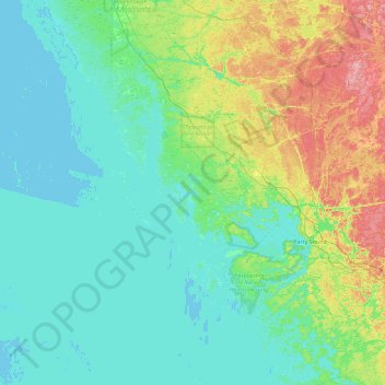
Name: Fairfield Island topographic map, elevation, terrain.

Location: Fairfield Island, Carling Township, Parry Sound District, Central Ontario, Ontario, Canada (45.10430 -80.63167 45.74430 -79.99167)

Average elevation: 653 ft

Minimum elevation: 564 ft

Maximum elevation: 1,004 ft

Other topographic maps

Click on a map to view its topography, its elevation and its terrain.

Gear up for your next adventure:

🪑Ultralight Camp Chairs - Portable seating for resting after a long day of mapping
🧥Waterproof Jacket for Hiking - Breathable and rugged rain jacket for outdoor excursions
🛌Ultralight Sleeping Bags - Compact down bags for cold nights in the wilderness
📱Heavy-Duty Phone Cases - Drop-proof and waterproof protection for outdoor navigation
🔭Stargazing Telescopes - Perfect for camping in low-light pollution areas shown on maps

As an Amazon Associate, this site earns from qualifying purchases at no extra cost to you.