Geolocate

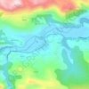
Cuñaba topographic map

Click on the map to display elevation.

About this map

Name: Cuñaba topographic map, elevation, terrain.

Location: Cuñaba, Peñamellera Baja, Asturias, España (43.26395 -4.70604 43.30182 -4.60662)

Average elevation: 1,890 ft

Minimum elevation: 102 ft

Maximum elevation: 5,089 ft

Other topographic maps

Click on a map to view its topography, its elevation and its terrain.

Lles

España > Asturias > Peñamellera Baja

Average elevation: 817 ft

Narganes

España > Asturias > Peñamellera Baja > Narganes

Average elevation: 571 ft

Bores

España > Asturias > Peñamellera Baja > Bores

Average elevation: 1,125 ft

Tobes

España > Asturias > Peñamellera Baja

Average elevation: 988 ft

Panes

España > Asturias > Peñamellera Baja

Average elevation: 643 ft

Bores

España > Asturias > Peñamellera Baja

Average elevation: 1,125 ft

Gear up for your next adventure:

🌡️Portable Weather Meter - Track weather conditions on the trail
🔋Solar Power Banks - Keep your GPS and phone charged in remote wilderness areas
🪶Camping Sleeping Pad - Comfortable sleeping pad for backpacking
🌲Outdoor Survival Books - Best books on survival skills
🧭Pro Hiking Compasses - High-accuracy liquid-filled compasses for topographic orientation

As an Amazon Associate, this site earns from qualifying purchases at no extra cost to you.