Geolocate

Diamond Point topographic map

Click on the map to display elevation.

About this map

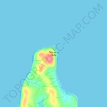
Name: Diamond Point topographic map, elevation, terrain.

Location: Diamond Point, Pacific County, Washington, United States (46.49702 -123.98088 46.49712 -123.98078)

Average elevation: 20 ft

Minimum elevation: 0 ft

Maximum elevation: 266 ft

Pacific County trails, hiking, mountain biking, running and outdoor activities

Other topographic maps

Click on a map to view its topography, its elevation and its terrain.

Chinook

United States > Washington > Pacific County

Average elevation: 10 ft

South Bend

United States > Washington > Pacific County

Average elevation: 75 ft

Bay Center

United States > Washington > Pacific County

Average elevation: 10 ft

Gear up for your next adventure:

🛡️Insect Repellent - Protection against bugs during outdoor activities
🛌Ultralight Sleeping Bags - Compact down bags for cold nights in the wilderness
🧭Outdoor Navigation Book - Learn advanced navigation skills
🪑Portable Camp Table - Compact table for campsite meals
💧Water Purification System - Clean water on the trail with reliable purifiers

As an Amazon Associate, this site earns from qualifying purchases at no extra cost to you.