
Greenville topographic map
Interactive map
Click on the map to display elevation.
About this map
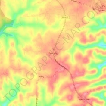
Name: Greenville topographic map, elevation, terrain.
Average elevation: 784 ft
Minimum elevation: 594 ft
Maximum elevation: 883 ft
Davidson County trails, hiking, mountain biking, running and outdoor activities
Other topographic maps
Click on a map to view its topography, its elevation and its terrain.
Edwin Warner Park
United States > Tennessee > Davidson County > Nashville > Devonshire Manor
Average elevation: 650 ft
Tennessee State Capitol
United States > Tennessee > Davidson County > Nashville
Average elevation: 456 ft