
Tobermory topographic map
Click on the map to display elevation.
Tobermory
The deep waters at the mouth of Georgian Bay are home to Fathom Five, Canada's first National Marine Conservation Area. The park preserves a rich cultural legacy that includes 22 shipwrecks and several historic lighthouses. Fathom Five's freshwater ecosystem contains some of the most pristine waters of the Great Lakes. The rugged islands of the park are a reminder of the impressive lake-bed topography found beneath the waves. There are glass-bottom cruises at Tobermory which offer tours to the park, as well as the rugged north coast of the Bruce Peninsula.
About this map
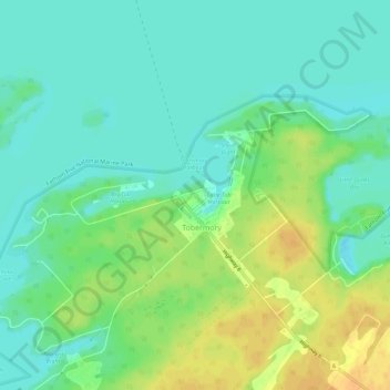
Name: Tobermory topographic map, elevation, terrain.
Average elevation: 597 ft
Minimum elevation: 558 ft
Maximum elevation: 659 ft