Geolocate

Island Lake topographic map

Click on the map to display elevation.

About this map

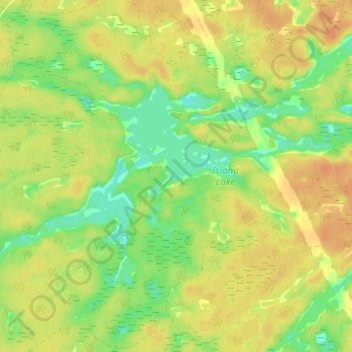
Name: Island Lake topographic map, elevation, terrain.

Location: Island Lake, Parry Sound District, Central Ontario, Ontario, Canada (45.74267 -80.30926 45.76521 -80.24745)

Average elevation: 732 ft

Minimum elevation: 666 ft

Maximum elevation: 778 ft

Other topographic maps

Click on a map to view its topography, its elevation and its terrain.

Novar

Canada > Ontario > Parry Sound District > Perry Township

Average elevation: 1,142 ft

Adanac

Canada > Ontario > Parry Sound District > Carling Township

Average elevation: 574 ft

Doe Lake

Canada > Ontario > Parry Sound District > Ryerson Township

Average elevation: 1,020 ft

Parry Sound

Canada > Ontario > Parry Sound District > Parry Sound

Average elevation: 663 ft

Gear up for your next adventure:

🛠️Outdoor Gear Repair Kit - Essential tools to fix gear on the trail
🌡️Portable Weather Meter - Track weather conditions on the trail
🧤Hiking Gloves - Protective gloves for rugged trails
🪶Trail Camera - Capture wildlife on your hikes
🏕️Family Camping Gear - Essentials for group camping trips

As an Amazon Associate, this site earns from qualifying purchases at no extra cost to you.