
Torres del Río topographic map
Interactive map
Click on the map to display elevation.
About this map
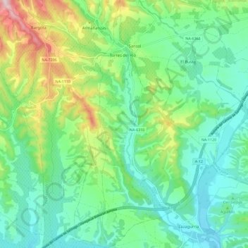
Name: Torres del Río topographic map, elevation, terrain.
Location: Torres del Río, Montejurra, Navarre, Espagne (42.48618 -2.28331 42.56983 -2.24915)
Average elevation: 1,539 ft
Minimum elevation: 1,234 ft
Maximum elevation: 2,306 ft
Other topographic maps
Click on a map to view its topography, its elevation and its terrain.
Armañanzas
Espagne > Navarre > Montejurra
Armañanzas, Montejurra, Navarre, Espagne
Average elevation: 1,614 ft
Lerate
Espagne > Navarre > Montejurra > Guesálaz
Lerate, Guesálaz, Montejurra, Navarre, 31291, Espagne
Average elevation: 1,729 ft