Geolocate

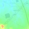
Ashta topographic map

Click on the map to display elevation.

About this map

Name: Ashta topographic map, elevation, terrain.

Location: Ashta, Ashta Tahsil, Sehore, Madhya Pradesh, India (22.98836 76.69646 23.03414 76.74416)

Average elevation: 1,627 ft

Minimum elevation: 1,585 ft

Maximum elevation: 1,660 ft

Other topographic maps

Click on a map to view its topography, its elevation and its terrain.

Neelbad

India > Madhya Pradesh > Ashta Tahsil

Average elevation: 1,709 ft

Lakhmipur

India > Madhya Pradesh > Ashta Tahsil

Average elevation: 1,588 ft

Gear up for your next adventure:

🎒Waterproof Dry Bags - Keep your electronics and maps dry inside your pack
🎒Trail Energy Bars - High‑calorie bars for hiking energy
🏥Hiking First Aid Kits - Comprehensive medical kits for remote trail injuries
🖼️Topo Map Wall Art - Decorative topographic prints of famous peaks and regions
👟Men's Trail Runners - Lightweight footwear for fast-paced exploration and light hiking

As an Amazon Associate, this site earns from qualifying purchases at no extra cost to you.