Geolocate

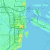
Miami River topographic map

Click on the map to display elevation.

About this map
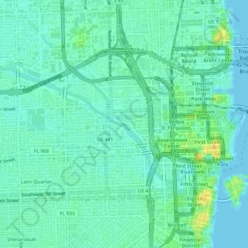
Name: Miami River topographic map, elevation, terrain.

Location: Miami River, Miami, Miami-Dade County, Florida, 33131, United States (25.76864 -80.22661 25.78635 -80.18729)

Average elevation: 33 ft

Minimum elevation: -16 ft

Maximum elevation: 118 ft

Miami-Dade County trails, hiking, mountain biking, running and outdoor activities

Other topographic maps

Click on a map to view its topography, its elevation and its terrain.
Coconut Grove

United States > Florida > Miami-Dade County > Miami

Average elevation: 26 ft

The Roads

United States > Florida > Miami-Dade County > Miami

Average elevation: 23 ft

Shenandoah

United States > Florida > Miami-Dade County > Miami

Average elevation: 30 ft

Dodge Island

United States > Florida > Miami-Dade County > Miami

Average elevation: 7 ft

The Pines

United States > Florida > Miami-Dade County > Miami

Average elevation: 30 ft

Gear up for your next adventure:

🔭Compact Binoculars - HD vision for scouting terrain and identifying distant landmarks
🪶Fire Starter Kit - Reliable fire starter for survival and camping
🥾Women's Hiking Boots - Top-rated trail boots with ankle support and superior grip
🔦Powerful Headlamps - Ultra-bright hands-free lighting for night navigation
🚗GPS Dash Cams - Record your scenic drives through mountain passes and canyons

As an Amazon Associate, this site earns from qualifying purchases at no extra cost to you.