Geolocate

Miami topographic maps

Click on a map to view its topography, its elevation and its terrain.

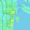
Miami River

United States > Florida > Miami-Dade County > Miami

Average elevation: 23 ft

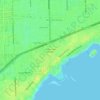
The Pines

United States > Florida > Miami-Dade County > Miami

Average elevation: 30 ft

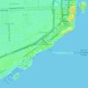
The Roads

United States > Florida > Miami-Dade County > Miami

Average elevation: 23 ft

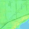
Shenandoah

United States > Florida > Miami-Dade County > Miami

Average elevation: 30 ft

Coconut Grove

United States > Florida > Miami-Dade County > Miami

Average elevation: 26 ft

Miami River

United States > Florida > Miami-Dade County > Miami

Average elevation: 33 ft

Dodge Island

United States > Florida > Miami-Dade County > Miami

Average elevation: 7 ft

About this place

Gear up for your next adventure:

🦶Carbon Trekking Poles - Reduce knee impact on steep descents with ultra-light poles
🗺️NatGeo Topo Maps - High-quality waterproof printed topographic maps of US Parks
🧥Waterproof Jacket for Hiking - Breathable and rugged rain jacket for outdoor excursions
🥤Water Filter Bottle - All‑in‑one filter bottle for safe hydration
📱Heavy-Duty Phone Cases - Drop-proof and waterproof protection for outdoor navigation

As an Amazon Associate, this site earns from qualifying purchases at no extra cost to you.