
郎木寺镇 topographic map
Interactive map
Click on the map to display elevation.
About this map
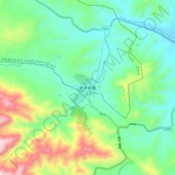
Name: 郎木寺镇 topographic map, elevation, terrain.
Location: 郎木寺镇, 碌曲县, 甘南藏族自治州, 甘肃省, 中国 (34.05112 102.59383 34.13112 102.67383)
Average elevation: 11,539 ft
Minimum elevation: 10,610 ft
Maximum elevation: 13,812 ft
Other topographic maps
Click on a map to view its topography, its elevation and its terrain.