Geolocate

Chiclayo topographic map

Click on the map to display elevation.

About this map

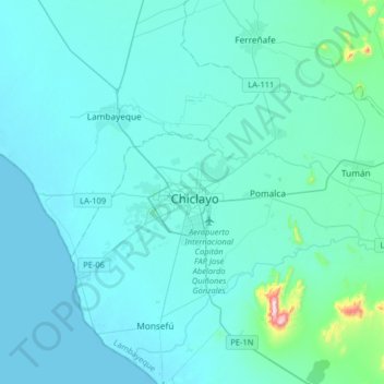
Name: Chiclayo topographic map, elevation, terrain.

Location: Chiclayo, Province of Chiclayo, Lambayeque, 5174, Peru (-6.92642 -80.00083 -6.60642 -79.68083)

Average elevation: 128 ft

Minimum elevation: -10 ft

Maximum elevation: 1,870 ft

Gear up for your next adventure:

🌡️Handheld Weather Meters - Measure wind, temp, and pressure for safe mountain travel
❄️Traction Cleats - Prevent slips on icy trails during winter hikes
🦟Ultrasonic Repellers - Create a bug-free zone at your camp or rest stop
🛌Ultralight Sleeping Bags - Compact down bags for cold nights in the wilderness
🌡️Portable Weather Meter - Track weather conditions on the trail

As an Amazon Associate, this site earns from qualifying purchases at no extra cost to you.