
Lamb Range topographic map
Click on the map to display elevation.
About this map
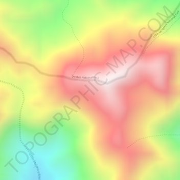
Name: Lamb Range topographic map, elevation, terrain.
Location: Lamb Range, Cairns, Queensland, Australia (-17.05778 145.67861 -17.03778 145.69861)
Average elevation: 2,457 ft
Minimum elevation: 912 ft
Maximum elevation: 3,579 ft
Other topographic maps
Click on a map to view its topography, its elevation and its terrain.
Kanimbla
Australia > Queensland > Cairns
The suburb straddles the upper reaches of Moody's Creek and is bordered to the north by the Cairns Western Arterial Road (state route 91). The main road that goes through Kanimbla is Ramsey Drive. Along the middle of the northern boundary is Whites Gap. In the south west elevations reach heights greater than…
Average elevation: 397 ft