
Aho topographic map
Click on the map to display elevation.
About this map
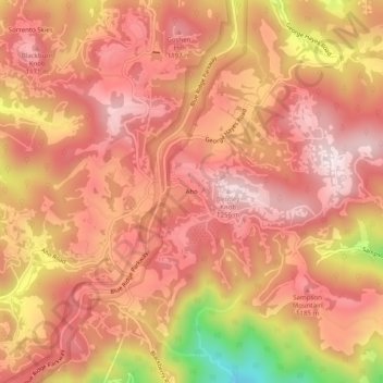
Name: Aho topographic map, elevation, terrain.
Location: Aho, Watauga County, North Carolina, United States (36.13930 -81.63649 36.17930 -81.59649)
Average elevation: 3,642 ft
Minimum elevation: 2,559 ft
Maximum elevation: 4,108 ft
Watauga County trails, hiking, mountain biking, running and outdoor activities
Other topographic maps
Click on a map to view its topography, its elevation and its terrain.
Grandfather Mountain State Park
United States > North Carolina > Watauga County > Banner Elk
Grandfather Mountain rises 5,964 feet (1,818 m) above sea level, and due to the considerable elevation gain the mountain boasts 16 distinct ecological communities. The mountain is famous for its rugged character, and is home to many hidden caves and significant cliffs.
Average elevation: 4,242 ft
Moses H Cone Memorial Park
United States > North Carolina > Watauga County > Blowing Rock
Average elevation: 3,678 ft