

Ures topographic map
Click on the map to display elevation.
Ures
The municipality is nestled within the mountains, hills, and valleys that form the edge of the Western Sierra Madre. The elevation of the administrative seat was 420 meters above sea level.
About this map

Name: Ures topographic map, elevation, terrain.
Location: Ures, Sonora, 84900, Mexico (29.00865 -110.63174 29.70625 -109.95559)
Average elevation: 2,057 ft
Minimum elevation: 889 ft
Maximum elevation: 5,699 ft
Other topographic maps
Click on a map to view its topography, its elevation and its terrain.
Hermosillo
Mexico > Sonora > Hermosillo
The Cerro de la Campana mountain is one of the symbols of Hermosillo. Its summit is 350 metres (1,150 ft) above the valley floor and contains a lookout called El Caracol, which was inaugurated in 1909. There are two theories as to the origin of the mountain's name. One states that it is from a peculiar…
Average elevation: 814 ft

Ciudad Obregón
The city is located on the parallel 27–29' north latitude and the meridian 109-59' west longitude. With an altitude above sea level of 40.8 m (134 ft) in the city center.
Average elevation: 194 ft
Hermosillo
Mexico > Sonora > Hermosillo
The Cerro de la Campana mountain is one of the symbols of Hermosillo. Its summit is 350 metres (1,150 ft) above the valley floor and contains a lookout called El Caracol, which was inaugurated in 1909. There are two theories as to the origin of the mountain's name. One states that it is from a peculiar…
Average elevation: 814 ft

Ciudad Obregón
The city is located on the parallel 27–29' north latitude and the meridian 109-59' west longitude. With an altitude above sea level of 40.8 m (134 ft) in the city center.
Average elevation: 194 ft
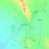
Hermosillo
Mexico > Sonora > Hermosillo > Hermosillo
The Cerro de la Campana mountain is one of the symbols of Hermosillo. Its summit is 350 metres (1,150 ft) above the valley floor and contains a lookout called El Caracol, which was inaugurated in 1909. There are two theories as to the origin of the mountain's name. One states that it is from a peculiar…
Average elevation: 814 ft

Hermosillo
Mexico > Sonora > Hermosillo
The Cerro de la Campana mountain is one of the symbols of Hermosillo. Its summit is 350 metres (1,150 ft) above the valley floor and contains a lookout called El Caracol, which was inaugurated in 1909. There are two theories as to the origin of the mountain's name. One states that it is from a peculiar…
Average elevation: 814 ft





Presa Adolfo Ruiz Cortines
Mexico > Sonora > Álamos > El Mocúzarit (Conicárit) > Campamento de la CFE
Average elevation: 404 ft