
Grand View topographic map
Click on the map to display elevation.
Grand View
Grand View is located at 42°59′5″N 116°5′36″W / 42.98472°N 116.09333°W / 42.98472; -116.09333 (42.984803, -116.093277), at an elevation of 2,356 feet (718 m) above sea level. The city is on the Snake River, which is the border with Elmore County.
About this map
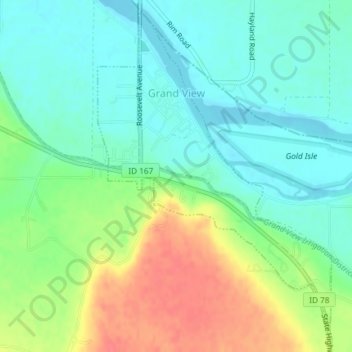
Name: Grand View topographic map, elevation, terrain.
Location: Grand View, Owyhee County, Idaho, United States (42.97062 -116.10170 42.99580 -116.07717)
Average elevation: 2,418 ft
Minimum elevation: 2,349 ft
Maximum elevation: 2,543 ft
Owyhee County trails, hiking, mountain biking, running and outdoor activities
Other topographic maps
Click on a map to view its topography, its elevation and its terrain.