
Make a donation
Gear up for your next adventure:
As an Amazon Associate, this site earns from qualifying purchases at no extra cost to you.
Florida Mountain topographic map
Click on the map to display elevation.
Make a donation
Gear up for your next adventure:
As an Amazon Associate, this site earns from qualifying purchases at no extra cost to you.
About this map
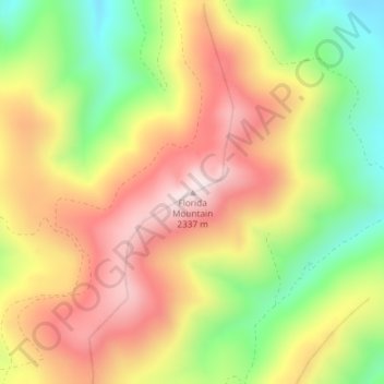
Name: Florida Mountain topographic map, elevation, terrain.
Location: Florida Mountain, Owyhee County, Idaho, United States (43.01521 -116.75539 43.01531 -116.75529)
Average elevation: 6,998 ft
Minimum elevation: 6,142 ft
Maximum elevation: 7,779 ft
Owyhee County trails, hiking, mountain biking, running and outdoor activities
Make a donation
Gear up for your next adventure:
As an Amazon Associate, this site earns from qualifying purchases at no extra cost to you.
Other topographic maps
Click on a map to view its topography, its elevation and its terrain.
Grand View
United States > Idaho > Owyhee County
Grand View is located at 42°59′5″N 116°5′36″W / 42.98472°N 116.09333°W / 42.98472; -116.09333 (42.984803, -116.093277), at an elevation of 2,356 feet (718 m) above sea level. The city is on the Snake River, which is the border with Elmore County.
Average elevation: 2,418 ft
Marsing
United States > Idaho > Owyhee County
Marsing is located at 43°32′44″N 116°48′28″W / 43.54556°N 116.80778°W / 43.54556; -116.80778 (43.545484, -116.807811), at an elevation of 2,300 feet (701 m) above sea level. The city is on the Snake River, which forms the border with Canyon County.
Average elevation: 2,277 ft