Geolocate

Latimer topographic map

Click on the map to display elevation.

About this map

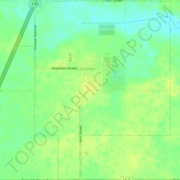
Name: Latimer topographic map, elevation, terrain.

Location: Latimer, Franklin County, Iowa, United States (42.74555 -93.38373 42.77462 -93.35019)

Average elevation: 1,237 ft

Minimum elevation: 1,204 ft

Maximum elevation: 1,263 ft

Franklin County trails, hiking, mountain biking, running and outdoor activities

Other topographic maps

Click on a map to view its topography, its elevation and its terrain.

Chapin

United States > Iowa > Franklin County

Average elevation: 1,135 ft

Bradford

United States > Iowa > Franklin County

Average elevation: 1,240 ft

Gear up for your next adventure:

🧥Waterproof Jacket for Hiking - Breathable and rugged rain jacket for outdoor excursions
🧢Outdoor Hiking Hat - Sun protection hat for outdoor explorers
📶Vehicle Signal Boosters - Improve reception in rural areas while driving to trailheads
🔭Telescopic Hiking Pole - Adjustable pole for hiking stability
🪵Folding Camp Saw - Compact saw for wood and campsite work

As an Amazon Associate, this site earns from qualifying purchases at no extra cost to you.