Geolocate

Chapin topographic map

Click on the map to display elevation.

About this map

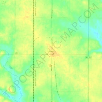
Name: Chapin topographic map, elevation, terrain.

Location: Chapin, Franklin County, Iowa, 50427, United States (42.81502 -93.24228 42.85502 -93.20228)

Average elevation: 1,135 ft

Minimum elevation: 1,079 ft

Maximum elevation: 1,175 ft

Franklin County trails, hiking, mountain biking, running and outdoor activities

Other topographic maps

Click on a map to view its topography, its elevation and its terrain.

Sheffield

United States > Iowa > Franklin County

Average elevation: 1,096 ft

Popejoy

United States > Iowa > Franklin County

Average elevation: 1,158 ft

Hansell

United States > Iowa > Franklin County

Average elevation: 1,033 ft

Hampton

United States > Iowa > Franklin County

Average elevation: 1,135 ft

Geneva

United States > Iowa > Franklin County

Average elevation: 1,086 ft

Coulter

United States > Iowa > Franklin County

Average elevation: 1,237 ft

Alexander

United States > Iowa > Franklin County

Average elevation: 1,247 ft

Latimer

United States > Iowa > Franklin County

Average elevation: 1,237 ft

Gear up for your next adventure:

💧Water Purification System - Clean water on the trail with reliable purifiers
📦Gear Storage Bags - Organize and protect outdoor equipment
Backpacking Tent - Lightweight and durable tent for multi‑day hikes
📶Vehicle Signal Boosters - Improve reception in rural areas while driving to trailheads
🖼️Topo Map Wall Art - Decorative topographic prints of famous peaks and regions

As an Amazon Associate, this site earns from qualifying purchases at no extra cost to you.