
Interlochen topographic map
Click on the map to display elevation.
About this map
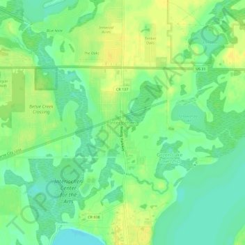
Name: Interlochen topographic map, elevation, terrain.
Average elevation: 846 ft
Minimum elevation: 810 ft
Maximum elevation: 879 ft
Grand Traverse County trails, hiking, mountain biking, running and outdoor activities
Other topographic maps
Click on a map to view its topography, its elevation and its terrain.
Traverse City
United States > Michigan > Grand Traverse County
The locale and topography is conducive for road bicycling, aided by the TART trail system. A map with routes, different trips, advice and local knowledge is available. Lake Michigan presents a location for sailing, fishing, and kayaking.
Average elevation: 669 ft
Grand Traverse Commons Natural Area
United States > Michigan > Grand Traverse County > Traverse City
Average elevation: 666 ft
Traverse City
United States > Michigan > Grand Traverse County
The locale and topography is conducive for road bicycling, aided by the TART trail system. A map with routes, different trips, advice and local knowledge is available. Lake Michigan presents a location for sailing, fishing, and kayaking.
Average elevation: 669 ft