
Hazlemere topographic map
Click on the map to display elevation.
About this map
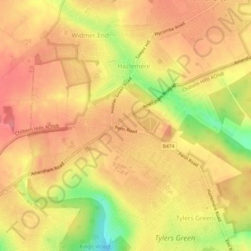
Name: Hazlemere topographic map, elevation, terrain.
Average elevation: 541 ft
Minimum elevation: 374 ft
Maximum elevation: 620 ft
Other topographic maps
Click on a map to view its topography, its elevation and its terrain.
Hotley Bottom
United Kingdom > England > Buckinghamshire > Great Missenden > Prestwood
Average elevation: 597 ft
Rammamere Heath
United Kingdom > England > Buckinghamshire > Heath and Reach
Average elevation: 453 ft
Wapsey's Wood Landfill Site
United Kingdom > England > Buckinghamshire > Beaconsfield > Jordans
Average elevation: 305 ft
Doddershall Wood
United Kingdom > England > Buckinghamshire > Grendon Underwood
Average elevation: 253 ft