
Loudwater topographic map
Click on the map to display elevation.
About this map
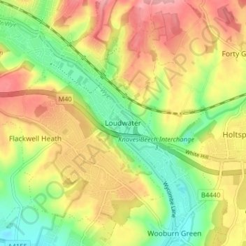
Name: Loudwater topographic map, elevation, terrain.
Location: Loudwater, Buckinghamshire, England, HP10 9TS, United Kingdom (51.58568 -0.71694 51.62568 -0.67694)
Average elevation: 299 ft
Minimum elevation: 98 ft
Maximum elevation: 502 ft
Other topographic maps
Click on a map to view its topography, its elevation and its terrain.