Geolocate

Dafang topographic map

Click on the map to display elevation.

About this map

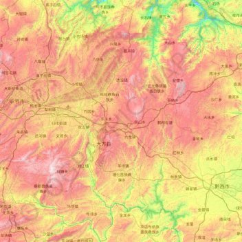
Name: Dafang topographic map, elevation, terrain.

Location: Dafang, Bijie, Guizhou, China (26.83456 105.25964 27.60456 106.13435)

Average elevation: 4,875 ft

Minimum elevation: 2,451 ft

Maximum elevation: 7,385 ft

Other topographic maps

Click on a map to view its topography, its elevation and its terrain.

Xiangshui

China > Guizhou > Dafang

Average elevation: 4,675 ft

Gear up for your next adventure:

👖Convertible Hiking Pants - Versatile zip-off pants for changing altitudes and temperatures
🔥Fast-Boil Camping Stoves - Efficient cooking systems for quick trail meals
💧Water Filtration Bottles - Safely drink from streams and lakes while exploring
🥾Men's Hiking Boots - Durable, waterproof footwear for rugged terrain and steep inclines
🚁Photography Drones - Capture stunning aerial views of landforms and topography

As an Amazon Associate, this site earns from qualifying purchases at no extra cost to you.