
Indianola topographic map
Interactive map
Click on the map to display elevation.
About this map
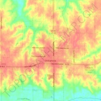
Name: Indianola topographic map, elevation, terrain.
Location: Indianola, Warren County, Iowa, 50125, United States (41.33250 -93.61124 41.40235 -93.52032)
Average elevation: 912 ft
Minimum elevation: 791 ft
Maximum elevation: 988 ft
Warren County trails, hiking, mountain biking, running and outdoor activities
Other topographic maps
Click on a map to view its topography, its elevation and its terrain.