
Thank you for supporting this site ❤️
Make a donation
Make a donation
Gear up for your next adventure:
As an Amazon Associate, this site earns from qualifying purchases at no extra cost to you.
Otterville topographic map
Click on the map to display elevation.
Thank you for supporting this site ❤️
Make a donation
Make a donation
Gear up for your next adventure:
As an Amazon Associate, this site earns from qualifying purchases at no extra cost to you.
About this map
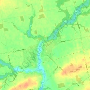
Name: Otterville topographic map, elevation, terrain.
Location: Otterville, Norwich, Oxford County, Ontario, N0J 1R0, Canada (42.90649 -80.62342 42.94649 -80.58342)
Average elevation: 814 ft
Minimum elevation: 741 ft
Maximum elevation: 883 ft
Thank you for supporting this site ❤️
Make a donation
Make a donation
Gear up for your next adventure:
As an Amazon Associate, this site earns from qualifying purchases at no extra cost to you.