Geolocate

Ayan topographic map

Click on the map to display elevation.

About this map
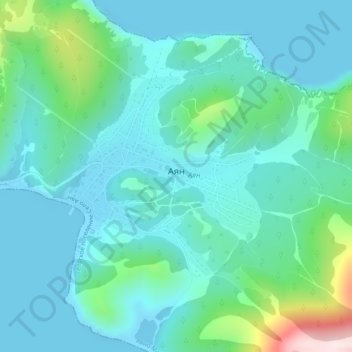
Name: Ayan topographic map, elevation, terrain.

Location: Ayan, сельское поселение Аян, Ayano-Maysky Rayon, Khabarovsk Krai, Far Eastern Federal District, 682571, Russia (56.45284 138.16561 56.46817 138.19393)

Average elevation: 259 ft

Minimum elevation: -13 ft

Maximum elevation: 1,430 ft

Other topographic maps

Click on a map to view its topography, its elevation and its terrain.

Dzhugdzhur Mountains

Russia > Khabarovsk Krai > Ayano-Maysky Rayon

The coastal stretch of the range is populated by Japanese stone pine and Dahurian larch. Parts of the range occupied by the Okhotsk-Manchurian taiga ecoregion contain swathes of Jezo spruce up to elevations of 1,300 m.

Average elevation: 5,131 ft

Gear up for your next adventure:

🎁Geography Themed Gifts - Unique gift ideas for map lovers and geography enthusiasts
🧭Outdoor Navigation Book - Learn advanced navigation skills
🗺️NatGeo Topo Maps - High-quality waterproof printed topographic maps of US Parks
🔦Powerful Headlamps - Ultra-bright hands-free lighting for night navigation
⌚Solar GPS Watches - Advanced multisport watches with built-in topographic maps

As an Amazon Associate, this site earns from qualifying purchases at no extra cost to you.