

Caranavi topographic map
Click on the map to display elevation.
About this map

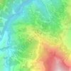
Name: Caranavi topographic map, elevation, terrain.
Location: Caranavi, La Paz, Bolivia (-16.05842 -67.68246 -15.33106 -67.13447)
Average elevation: 3,465 ft
Minimum elevation: 1,047 ft
Maximum elevation: 8,976 ft
Other topographic maps
Click on a map to view its topography, its elevation and its terrain.
La Paz
Bolivia > La Paz > Pedro Domingo Murillo > La Paz
The city, in west-central Bolivia 68 km (42 mi) southeast of Lake Titicaca, is set in a canyon created by the Choqueyapu River. It is in a bowl-like depression, part of the Amazon basin, surrounded by the high mountains of the Altiplano. Overlooking the city is the towering, triple-peaked Illimani. Its peaks…
Average elevation: 13,409 ft

Isla del Sol
Bolivia > La Paz > Provincia Manco Kapac > Challa Isla del Sol
Average elevation: 12,608 ft
El Alto
El Alto (Spanish for "The High One", Aymara: Patamarka) is the second-largest city in Bolivia, located adjacent to La Paz in Pedro Domingo Murillo Province on the Altiplano highlands. El Alto is today one of Bolivia's fastest-growing urban centers, with an estimated population of 943,558 in 2020. It is also…
Average elevation: 13,212 ft

Pico Condoriri
Bolivia > La Paz > Provincia Los Andes > Municipio Batallas
Average elevation: 16,873 ft
El Alto
El Alto (Spanish for "The High One", Aymara: Patamarka) is the second-largest city in Bolivia, located adjacent to La Paz in Pedro Domingo Murillo Province on the Altiplano highlands. El Alto is today one of Bolivia's fastest-growing urban centers, with an estimated population of 943,558 in 2020. It is also…
Average elevation: 13,212 ft
Huayna Potosí
Bolivia > La Paz > Provincia Los Andes > Pucarani
Huayna Potosí is a fold mountain located in western Bolivia, near the city of El Alto and approximately 25 km (16 mi) north of La Paz, the country's administrative capital. It rises to an elevation of 6,088 m (19,974 ft) above sea level and forms part of the Cordillera Real range of the larger Andes, which…
Average elevation: 17,631 ft

Copacabana
Bolivia > La Paz > Provincia Manco Kapac
Copacabana features a cold subtropical highland climate (Köppen: Cwc, Trewartha: Cwlk) - a rare type of climate, but commonplace near most of Lake Titicaca. Similar to many areas with this climate, Copacabana features a markedly drier "low-sun" season. Because of the high altitude of Copacabana, the town is…
Average elevation: 12,923 ft
Illimani
Bolivia > La Paz > Pedro Domingo Murillo > Palca
Illimani (Aymara and Spanish pronunciation: [iʎiˈmani]) is a prominent fold mountain within the Cordillera Real of Bolivia, a subrange of the greater Andes, and located approximately 82 kilometres (51 mi) southeast of La Paz. With an elevation of 6,438 metres (21,120 ft) at its summit, it is the highest…
Average elevation: 18,885 ft
Copacabana
Bolivia > La Paz > Provincia Manco Kapac
Copacabana has a dry-winter subpolar oceanic climate (Cwb), a rare variant of this type of climate, but commonplace near most of Lake Titicaca. Similar to many areas with this climate, Copacabana features a markedly drier "low-sun" season. Because of the high altitude of Copacabana, the town is chilly…
Average elevation: 12,677 ft

Villa Cascada
Bolivia > La Paz > Provincia Sud Yungas > Municipio Palos Blancos
Average elevation: 2,999 ft

Santa Rosa de Kilo Kilo
Bolivia > La Paz > Provincia Nor Yungas > Municipio Coroico
Average elevation: 4,334 ft




Santiago de Machaca
Bolivia > La Paz > Provincia General José Manuel Pando > Municipio Santiago de Machaca
Average elevation: 12,707 ft

Caraguata
Bolivia > La Paz > Provincia Inquisivi > Municipio Licoma > Pencaloma
Average elevation: 7,192 ft



Jose Carrasco
Bolivia > La Paz > Caranavi > Caranavi > Carrasco La Reserva
Average elevation: 3,481 ft



25 de Septiembre
Bolivia > La Paz > Provincia Sud Yungas > Municipio Palos Blancos
Average elevation: 2,408 ft

Santiago de Huata
Bolivia > La Paz > Provincia Omasuyos > Municipio Santiago de Huata
Average elevation: 12,831 ft




Nueva Oscar
Bolivia > La Paz > Provincia Sud Yungas > Municipio Palos Blancos
Average elevation: 1,699 ft


Gaviota
Bolivia > La Paz > Provincia Larecaja > Municipio Teoponte > Gaviota
Average elevation: 1,214 ft


Santiago de Huata
Bolivia > La Paz > Provincia Omasuyos > Municipio Santiago de Huata
Average elevation: 12,831 ft
