Geolocate

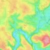
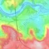
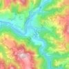
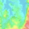
Fondamente topographic map

Click on the map to display elevation.

About this map

Name: Fondamente topographic map, elevation, terrain.

Location: Fondamente, Millau, Aveyron, Occitania, Metropolitan France, 12540, France (43.81359 3.05476 43.90133 3.19075)

Average elevation: 2,096 ft

Minimum elevation: 1,414 ft

Maximum elevation: 2,779 ft

Other topographic maps

Click on a map to view its topography, its elevation and its terrain.

La Tapie

France > Occitania > Aveyron > La Salvetat-Peyralès

Average elevation: 1,608 ft

Barrage de Maury

France > Occitania > Aveyron > Saint-Amans-des-Cots

Average elevation: 2,087 ft

Vanc

France > Occitania > Aveyron > Salles-la-Source

Average elevation: 1,670 ft

Vanc

France > Occitania > Aveyron > Salles-la-Source

Average elevation: 1,670 ft

Single

France > Occitania > Aveyron > Fondamente

Average elevation: 2,060 ft

Calcomier

France > Occitania > Aveyron > Rodez

Average elevation: 1,870 ft

Rouens

France > Occitania > Aveyron > Saint-Hippolyte

Average elevation: 1,975 ft

Saint-Germain

France > Occitania > Aveyron > Millau

Average elevation: 2,073 ft

La Bastide des Fonts

France > Occitania > Aveyron > Cornus

Average elevation: 2,277 ft

Ceyrac

France > Occitania > Aveyron > Gabriac

Average elevation: 1,952 ft

Issis

France > Occitania > Aveyron > Creissels

Average elevation: 1,772 ft

Le Mauron

France > Occitania > Aveyron > Maleville

Average elevation: 1,480 ft

Calcomier

France > Occitania > Aveyron > Rodez

Average elevation: 1,870 ft

Cantobre

France > Occitania > Aveyron > Nant

Average elevation: 2,185 ft

La Malette

France > Occitania > Aveyron > Entraygues-sur-Truyère

Average elevation: 1,345 ft

Puech de Montabez

France > Occitania > Aveyron > Florentin-la-Capelle

Average elevation: 2,172 ft

Taulan

France > Occitania > Aveyron > Roquefort-sur-Soulzon

Average elevation: 1,988 ft

Issis

France > Occitania > Aveyron > Creissels

Average elevation: 1,772 ft

Massip

France > Occitania > Aveyron > Golinhac

Average elevation: 1,877 ft

Leth

France > Occitania > Aveyron > Florentin-la-Capelle

Average elevation: 1,608 ft

Le Rouve

France > Occitania > Aveyron > Salles-Curan

Average elevation: 2,756 ft

Les Tour

France > Occitania > Aveyron > Druelle Balsac > Druelle

Average elevation: 1,909 ft

Le Contourès

France > Occitania > Aveyron > Castanet

Average elevation: 2,083 ft

Gear up for your next adventure:

☕Camping Coffee Makers - Enjoy premium coffee at the summit or campsite
🎁Geography Themed Gifts - Unique gift ideas for map lovers and geography enthusiasts
🌎3D Topographic Globes - Raised relief globes for a tactile understanding of geography
🧼Biodegradable Camping Soap - Eco‑friendly soap for outdoor hygiene
🪶Wildlife Field Guides - Learn animal tracking and species ID

As an Amazon Associate, this site earns from qualifying purchases at no extra cost to you.