Geolocate

Radway topographic map

Click on the map to display elevation.

About this map

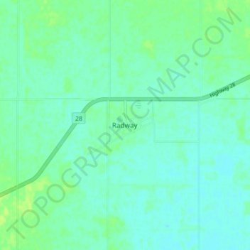
Name: Radway topographic map, elevation, terrain.

Location: Radway, Thorhild County, Alberta, Canada (54.04038 -112.96656 54.08038 -112.92656)

Average elevation: 2,077 ft

Minimum elevation: 2,060 ft

Maximum elevation: 2,100 ft

Gear up for your next adventure:

🥾Hiking Shoes - Durable and comfortable shoes for trail hiking
Backpacking Tents - Weight-optimized shelters for multi-day topographic surveys
🧭Map Reading Tools - Tools and kits for map navigation
🛌Ultralight Sleeping Bags - Compact down bags for cold nights in the wilderness
🗺️NatGeo Topo Maps - High-quality waterproof printed topographic maps of US Parks

As an Amazon Associate, this site earns from qualifying purchases at no extra cost to you.