Geolocate

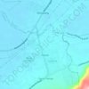
Prinza topographic map

Click on the map to display elevation.

About this map

Name: Prinza topographic map, elevation, terrain.

Location: Prinza, Calauan, Laguna, Calabarzon, 4012, Philippines (14.12125 121.29745 14.16125 121.33745)

Average elevation: 230 ft

Minimum elevation: 26 ft

Maximum elevation: 1,476 ft

Other topographic maps

Click on a map to view its topography, its elevation and its terrain.
Dayap

Philippines > Laguna > Calauan

Average elevation: 62 ft

Silangan

Philippines > Laguna > Calauan

Average elevation: 79 ft

Mabacan

Philippines > Laguna > Calauan

Average elevation: 112 ft

Perez

Philippines > Laguna > Calauan

Average elevation: 269 ft

Masiit

Philippines > Laguna > Calauan

Average elevation: 39 ft

Imoc

Philippines > Laguna > Calauan

Average elevation: 410 ft

Masiit

Philippines > Laguna > Calauan

Average elevation: 39 ft

Masiit

Philippines > Laguna > Calauan

Average elevation: 39 ft

Mabacan

Philippines > Laguna > Calauan

Average elevation: 112 ft

Perez

Philippines > Laguna > Calauan

Average elevation: 269 ft

Gear up for your next adventure:

🥾Hiking Shoes - Durable and comfortable shoes for trail hiking
🩳Quick‑Dry Hiking Shorts - Comfortable and quick‑dry shorts for summer hiking
🧭Hiking Compass - Precision compass for reliable navigation in the wilderness
🔌USB Car Charger - Car charger for on‑the‑go power needs
🔦Powerful Headlamps - Ultra-bright hands-free lighting for night navigation

As an Amazon Associate, this site earns from qualifying purchases at no extra cost to you.