
Hagerman Lake topographic map
Click on the map to display elevation.
About this map
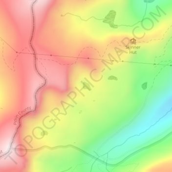
Name: Hagerman Lake topographic map, elevation, terrain.
Location: Hagerman Lake, Lake County, Colorado, United States (39.25825 -106.47353 39.25963 -106.47175)
Average elevation: 11,430 ft
Minimum elevation: 10,377 ft
Maximum elevation: 12,329 ft
Lake County trails, hiking, mountain biking, running and outdoor activities
Other topographic maps
Click on a map to view its topography, its elevation and its terrain.