
Fort Fraser topographic map
Click on the map to display elevation.
About this map
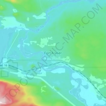
Name: Fort Fraser topographic map, elevation, terrain.
Average elevation: 2,402 ft
Minimum elevation: 2,156 ft
Maximum elevation: 3,750 ft
Other topographic maps
Click on a map to view its topography, its elevation and its terrain.
Dorman Lake
Canada > British Columbia > Regional District of Bulkley-Nechako > Area D (Endako/Fort Fraser)
Average elevation: 2,598 ft
Emmett Lake
Canada > British Columbia > Regional District of Bulkley-Nechako > Area D (Endako/Fort Fraser)
Average elevation: 3,169 ft