
Kirensk topographic map
Interactive map
Click on the map to display elevation.
About this map
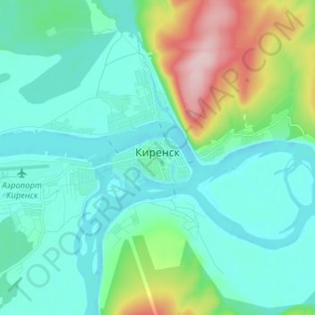
Name: Kirensk topographic map, elevation, terrain.
Average elevation: 948 ft
Minimum elevation: 781 ft
Maximum elevation: 1,585 ft
Other topographic maps
Click on a map to view its topography, its elevation and its terrain.
Ичера
Russia > Irkutsk Oblast > Киренский район
Ичера, Коршуновское сельское поселение, Киренский район, Irkutsk Oblast, Siberian Federal District, Russia
Average elevation: 902 ft