
Make a donation
Gear up for your next adventure:
As an Amazon Associate, this site earns from qualifying purchases at no extra cost to you.
Ичера topographic map
Click on the map to display elevation.
Make a donation
Gear up for your next adventure:
As an Amazon Associate, this site earns from qualifying purchases at no extra cost to you.
About this map
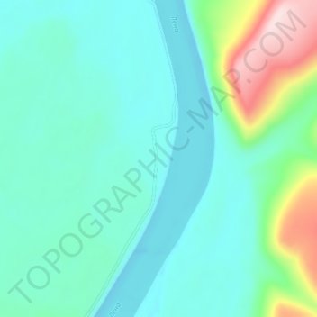
Name: Ичера topographic map, elevation, terrain.
Average elevation: 902 ft
Minimum elevation: 673 ft
Maximum elevation: 1,811 ft
Make a donation
Gear up for your next adventure:
As an Amazon Associate, this site earns from qualifying purchases at no extra cost to you.
Other topographic maps
Click on a map to view its topography, its elevation and its terrain.
Lena River
Russia > Irkutsk Oblast > Киренский район
The Lena originates at 1,640 meters (5,381 ft) of elevation in the Baikal Mountains, 7 kilometres (4 mi) west of Lake Baikal, south of the Central Siberian Plateau. The Lena flows north-east and traverses the Lena-Angara Plateau, then is joined by three tributary rivers: (i) the Kirenga, (ii) the Vitim, and…
Average elevation: 1,138 ft