Geolocate

Setomaa vald topographic map

Interactive map

Click on the map to display elevation.

About this map

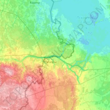
Name: Setomaa vald topographic map, elevation, terrain.

Location: Setomaa vald, Kreis Werro, Estland (57.58047 27.28982 58.10837 27.81911)

Average elevation: 259 ft

Minimum elevation: 89 ft

Maximum elevation: 738 ft

Other topographic maps

Click on a map to view its topography, its elevation and its terrain.

Antsla vald

Estland > Kreis Werro

Antsla vald, Kreis Werro, Estland

Average elevation: 282 ft

Rõuge vald

Estland > Kreis Werro

Rõuge vald, Kreis Werro, Estland

Average elevation: 394 ft

Werro

Estland > Kreis Werro > Werro

Werro, Kreis Werro, 65622, Estland

Average elevation: 269 ft

Saarde küla

Estland > Kreis Werro

Saarde küla, Võru vald, Kreis Werro, 65239, Estland

Average elevation: 594 ft

Werro

Estland > Kreis Werro

Werro, Kreis Werro, Estland

Average elevation: 262 ft