
Schijen topographic map
Interactive map
Click on the map to display elevation.
About this map
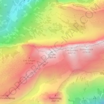
Name: Schijen topographic map, elevation, terrain.
Location: Schijen, Glarona, 6667, Svizzera (47.05922 8.99177 47.05932 8.99187)
Average elevation: 5,732 ft
Minimum elevation: 3,596 ft
Maximum elevation: 7,274 ft
Other topographic maps
Click on a map to view its topography, its elevation and its terrain.