Geolocate

Dowsby topographic map

Click on the map to display elevation.

About this map

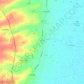
Name: Dowsby topographic map, elevation, terrain.

Location: Dowsby, South Kesteven, Lincolnshire, England, United Kingdom (52.84084 -0.37351 52.86119 -0.27504)

Average elevation: 59 ft

Minimum elevation: 0 ft

Maximum elevation: 190 ft

Other topographic maps

Click on a map to view its topography, its elevation and its terrain.

Stamford

United Kingdom > England > Lincolnshire > South Kesteven

Average elevation: 171 ft

Creeton

United Kingdom > England > Lincolnshire > South Kesteven

Average elevation: 223 ft

Lound

United Kingdom > England > Lincolnshire > South Kesteven > Toft

Average elevation: 128 ft

Fulbeck

United Kingdom > England > Lincolnshire > South Kesteven

Average elevation: 200 ft

Oasby

United Kingdom > England > Lincolnshire > South Kesteven

Average elevation: 269 ft

Stroxton

United Kingdom > England > Lincolnshire > South Kesteven

Average elevation: 371 ft

Bourne

United Kingdom > England > Lincolnshire > South Kesteven

Average elevation: 69 ft

Grantham

United Kingdom > England > Lincolnshire > South Kesteven

Average elevation: 285 ft

Aisby

United Kingdom > England > Lincolnshire > South Kesteven

Average elevation: 243 ft

Keisby

United Kingdom > England > Lincolnshire > South Kesteven

Average elevation: 220 ft

Hawthorpe

United Kingdom > England > Lincolnshire > South Kesteven

Average elevation: 213 ft

Toft

United Kingdom > England > Lincolnshire > South Kesteven

Average elevation: 121 ft

Irnham

United Kingdom > England > Lincolnshire > South Kesteven

Average elevation: 233 ft

Swinstead

United Kingdom > England > Lincolnshire > South Kesteven

Average elevation: 223 ft

Stamford

United Kingdom > England > Lincolnshire > South Kesteven

Average elevation: 171 ft

Manthorpe

United Kingdom > England > Lincolnshire > South Kesteven

Average elevation: 236 ft

Bourne

United Kingdom > England > Lincolnshire > South Kesteven

Average elevation: 69 ft

Bitchfield

United Kingdom > England > Lincolnshire > South Kesteven

Average elevation: 279 ft

Stamford

United Kingdom > England > Lincolnshire > South Kesteven

Average elevation: 171 ft

Marston

United Kingdom > England > Lincolnshire > South Kesteven

Average elevation: 115 ft

Ancaster

United Kingdom > England > Lincolnshire > South Kesteven

Average elevation: 220 ft

Barkston

United Kingdom > England > Lincolnshire > South Kesteven

Average elevation: 203 ft

Harlaxton

United Kingdom > England > Lincolnshire > South Kesteven

Average elevation: 335 ft

Brandon

United Kingdom > England > Lincolnshire > South Kesteven

Average elevation: 82 ft

Horbling

United Kingdom > England > Lincolnshire > South Kesteven

Average elevation: 39 ft

Barkston

United Kingdom > England > Lincolnshire > South Kesteven

Average elevation: 203 ft

Manthorpe

United Kingdom > England > Lincolnshire > South Kesteven

Average elevation: 105 ft

Langtoft

United Kingdom > England > Lincolnshire > South Kesteven

Average elevation: 26 ft

Baston

United Kingdom > England > Lincolnshire > South Kesteven

Average elevation: 33 ft

Pointon

United Kingdom > England > Lincolnshire > South Kesteven

Average elevation: 49 ft

Sempringham

United Kingdom > England > Lincolnshire > South Kesteven > Pointon

Sempringham consists of a church and a holy well, with other houses east from the church scattered along the B1177 between Pointon and Billingborough. The church stands at an altitude of about 52 feet (16 m), on land rising out of flat fenland. Pointon is the chief township of the civil parish, which includes…

Average elevation: 52 ft

Eastgate

United Kingdom > England > Lincolnshire > South Kesteven

Average elevation: 36 ft

Bulby

United Kingdom > England > Lincolnshire > South Kesteven

Average elevation: 203 ft

Pickworth

United Kingdom > England > Lincolnshire > South Kesteven

Average elevation: 217 ft

Folkingham

United Kingdom > England > Lincolnshire > South Kesteven

Average elevation: 148 ft

Swayfield

United Kingdom > England > Lincolnshire > South Kesteven

Average elevation: 269 ft

Bourne

United Kingdom > England > Lincolnshire > South Kesteven

Average elevation: 69 ft

Aslackby

United Kingdom > England > Lincolnshire > South Kesteven

Average elevation: 144 ft

Ingoldsby

United Kingdom > England > Lincolnshire > South Kesteven

Average elevation: 240 ft

Gunby

United Kingdom > England > Lincolnshire > South Kesteven

Average elevation: 400 ft

Stubton

United Kingdom > England > Lincolnshire > South Kesteven > Stubton

Average elevation: 75 ft

Ropsley

United Kingdom > England > Lincolnshire > South Kesteven

Average elevation: 299 ft

Foston

United Kingdom > England > Lincolnshire > South Kesteven

Average elevation: 95 ft

Stainby

United Kingdom > England > Lincolnshire > South Kesteven > Stainby

Average elevation: 413 ft

Barrowby

United Kingdom > England > Lincolnshire > South Kesteven

Average elevation: 253 ft

Newstead

United Kingdom > England > Lincolnshire > South Kesteven > Stamford

Average elevation: 118 ft

Austerby

United Kingdom > England > Lincolnshire > South Kesteven

Average elevation: 46 ft

Westby

United Kingdom > England > Lincolnshire > South Kesteven

Average elevation: 305 ft

Grantham

United Kingdom > England > Lincolnshire > South Kesteven

Average elevation: 285 ft

Gear up for your next adventure:

🎒Day Hiking Backpack - Lightweight backpack perfect for day trips and outdoor adventures
📖Nature Tracking Books - Learn to track wildlife and terrain
🔦Compact Flashlight - Reliable flashlight for emergencies
🦺Reflective Outdoor Gear - Safety gear for low‑light conditions
🧥Waterproof Jacket for Hiking - Breathable and rugged rain jacket for outdoor excursions

As an Amazon Associate, this site earns from qualifying purchases at no extra cost to you.