Geolocate

Jean topographic map

Click on the map to display elevation.

About this map

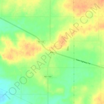
Name: Jean topographic map, elevation, terrain.

Location: Jean, Young County, Texas, United States (33.27622 -98.63645 33.31622 -98.59645)

Average elevation: 1,191 ft

Minimum elevation: 1,119 ft

Maximum elevation: 1,253 ft

Young County trails, hiking, mountain biking, running and outdoor activities

Other topographic maps

Click on a map to view its topography, its elevation and its terrain.

Graham

United States > Texas > Young County

Average elevation: 1,089 ft

Graham

United States > Texas > Young County

Average elevation: 1,089 ft

Gear up for your next adventure:

🏕️Tent Footprint - Protect your tent base from wear
👟Men's Trail Runners - Lightweight footwear for fast-paced exploration and light hiking
🧯Portable Fire Pit - Compact fire pit for camping spots
🪶Camping Sleeping Pad - Comfortable sleeping pad for backpacking
🧤Tactile Hiking Gloves - Keep hands warm while operating GPS and smartphone screens

As an Amazon Associate, this site earns from qualifying purchases at no extra cost to you.