Geolocate

Graham topographic map

Click on the map to display elevation.

About this map

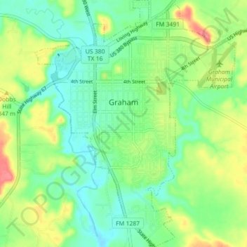
Name: Graham topographic map, elevation, terrain.

Location: Graham, Young County, Texas, 76450, United States (33.06730 -98.60663 33.12642 -98.54946)

Average elevation: 1,089 ft

Minimum elevation: 1,007 ft

Maximum elevation: 1,234 ft

Young County trails, hiking, mountain biking, running and outdoor activities

Other topographic maps

Click on a map to view its topography, its elevation and its terrain.

Padgett

United States > Texas > Young County

Average elevation: 1,204 ft

Jean

United States > Texas > Young County

Average elevation: 1,191 ft

Graham

United States > Texas > Young County

Average elevation: 1,089 ft

Olney

United States > Texas > Young County > Olney > Olney

Average elevation: 1,220 ft

Gear up for your next adventure:

🌧️Backpack Rain Cover - Keep gear dry in wet weather
📷Action Camera - Capture your outdoor adventures in HD
📶Satellite Messenger - Communication device off‑grid
🔥Plasma Lighters - Windproof lighters that work in any weather condition
📱Heavy-Duty Phone Cases - Drop-proof and waterproof protection for outdoor navigation

As an Amazon Associate, this site earns from qualifying purchases at no extra cost to you.