
Cerro Santo Domingo topographic map
Interactive map
Click on the map to display elevation.
About this map
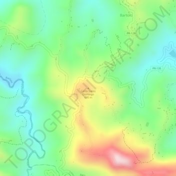
Name: Cerro Santo Domingo topographic map, elevation, terrain.
Average elevation: 1,880 ft
Minimum elevation: 1,424 ft
Maximum elevation: 2,612 ft
Puerto Rico trails, hiking, mountain biking, running and outdoor activities
Other topographic maps
Click on a map to view its topography, its elevation and its terrain.