Geolocate

Jelav topographic map

Click on the map to display elevation.

About this map

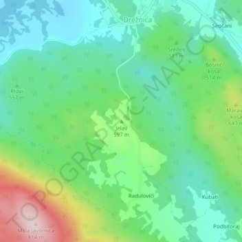
Name: Jelav topographic map, elevation, terrain.

Location: Jelav, Grad Ogulin, Karlovac County, 47313, Croatia (45.12529 15.08870 45.12539 15.08880)

Average elevation: 1,827 ft

Minimum elevation: 1,483 ft

Maximum elevation: 2,635 ft

Gear up for your next adventure:

🌡️Portable Weather Meter - Track weather conditions on the trail
🛡️Bear Spray Outdoor - Protection in bear country hikes
🥘Titanium Cookware - Durable, featherlight pots and pans for backpacking
😴Insulated Sleeping Pads - Compact and warm pads for high-elevation camping
🌧️Backpack Rain Cover - Keep gear dry in wet weather

As an Amazon Associate, this site earns from qualifying purchases at no extra cost to you.