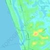
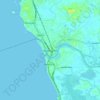
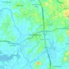
Colombo topographic map
Click on the map to display elevation.
About this map

Name: Colombo topographic map, elevation, terrain.
Location: Colombo, Colombo District, Western Province, Sri Lanka (6.86241 79.82046 6.98136 79.89000)
Average elevation: 16 ft
Minimum elevation: -7 ft
Maximum elevation: 108 ft
Other topographic maps
Click on a map to view its topography, its elevation and its terrain.


Olaboduwa North
Sri Lanka > Western Province > Horana DS Division > Olaboduwa
Average elevation: 82 ft










Seethawaka Export Processing Zone
Sri Lanka > Western Province > Avissawella > Seethawaka
Average elevation: 108 ft



Padukka
Padukka (Sinhala: පාදුක්ක, Tamil: பாதுக்கை) is a town in the district of Colombo in the Western Province of Sri Lanka. It has a population of roughly 8,000. Elevation 44feet.
Average elevation: 112 ft